


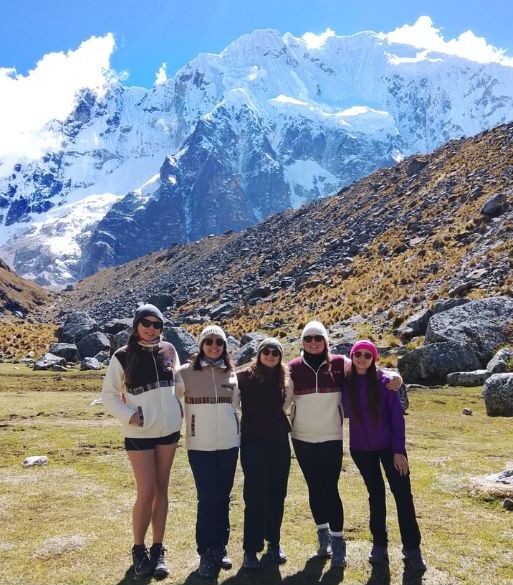
On the Salkantay Trek, you can see turquoise lagoons, snow-capped mountains, glaciers, high-altitude valleys, cloud forest, high jungle, and Machu Picchu. One of the main attractions of this route is the gradual change in landscapes and ecosystems: in just a few days, it takes you from cold, rocky terrain near 4.600 m above sea level to warm, humid, vegetation-covered areas.
This visual variety makes the route different from other hikes to Machu Picchu. The scenery changes with altitude, weather, and the time of year, so it is best to be prepared to see both snow-covered peaks and rivers, crops, and green mountains.
What Can You See on the Salkantay Trek?
The Salkantay Trek lets you take in high-mountain scenery, glacial lagoons, snow-capped peaks, broad valleys, humid forests, and jungle areas before arriving at Machu Picchu. The route combines open spaces with distant views of mountain summits and trails surrounded by dense vegetation.
The sequence of landscapes is a central part of the trek. Cold weather, rock, and grasslands dominate the high areas; farther down, trees, flowers, rivers, and crops begin to appear. Visibility can vary considerably due to mist, rain, or clouds, especially along the highest sections.
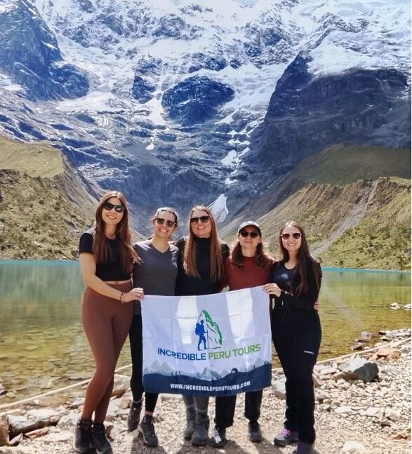
Humantay Lagoon
Humantay Lagoon is one of the best-known landscapes associated with the Salkantay Trek. Its turquoise waters lie at the foot of high mountains, in a setting shaped by rock deposits and glacial formations.
The color of the water can appear more or less intense depending on the light, weather, and season. From its shores, you can see the slopes surrounding the lagoon and, when the sky is clear, the nearby peaks. Reaching it involves a demanding uphill hike, so it is advisable to walk slowly and bring water, sunscreen, and clothing for sudden temperature changes.
Salkantay Snow-Capped Mountain
The snow-capped Salkantay mountain dominates much of the high-mountain scenery during the trek. Its snow-covered summits and glaciers are among the route’s main visual landmarks, especially in the areas near the mountain pass.
The best views depend on the conditions of the day. On clear mornings, it is possible to see the rock faces, accumulated snow, and glacial areas more clearly; in misty conditions, the mountain may be partially covered. For this reason, bringing a camera protected from moisture and not relying on a single time of day for photos is often a practical choice.
Salkantay Pass
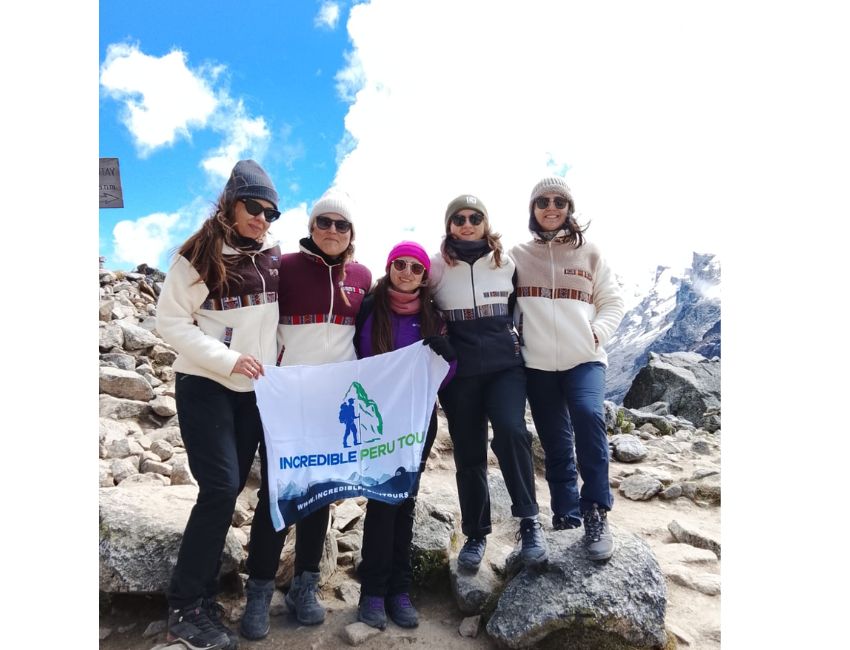
Salkantay Pass is one of the highest and most visually striking points of the trek. It is located near 4.600 m above sea level and features a rocky, open, exposed landscape, with surrounding mountains and close-up views of the snow-capped Salkantay mountain.
From this area, the contrast between high-altitude environments and the later descent toward greener areas is clear. Cold temperatures and wind can be intense, even when the day begins sunny. A waterproof jacket, thermal layers, and gloves help you stay comfortable while enjoying the surroundings.
Andean Mountains and Landscapes
During the Salkantay Trek, mountains are the constant feature along the initial sections. The trail crosses high basins, rocky slopes, mountain passes, and ravines that reveal the scale of Cusco’s terrain.
These landscapes do not always look the same. Clouds can change the appearance of a mountain within minutes, while morning light often provides a clearer view of the peaks. Afternoons, on the other hand, may bring mist or rain depending on the season.
High-Altitude Valleys
The route crosses broad valleys surrounded by mountains, where you can see high-altitude grasslands, streams, and trails following the natural contours of the land. These areas show how the scenery gradually changes as the altitude decreases.
In the valleys, you can spot grazing areas, small watercourses, and slopes with low vegetation. These sections are suitable for stopping to observe the surroundings without losing track of your hiking pace, as altitude can affect travelers who have not acclimatized well in Cusco.
Glaciers and Snow-Capped Peaks
Glaciers and snow-capped peaks accompany the highest sections of the Salkantay Trek. They can be seen mainly around the snow-capped Salkantay mountain and from open areas near Salkantay Pass.
Visibility depends on weather conditions and is not guaranteed. During the rainy season, cloud cover can be heavier, while the dry months usually bring clearer mornings, although nights and early mornings are also colder. It is best to keep flexible expectations and appreciate the scenery even when the peaks appear among the clouds.

Panoramic Views Along the Route
Different sections of the route offer open views of mountains, ravines, and valleys. At the higher passes, you can appreciate the vastness of the terrain, while on the descents, the mountains frame the trail and guide your gaze toward increasingly greener areas.
The variety of the landscape can also be seen in the details: changes in vegetation color, rivers flowing down the ravines, and trails connecting small farming areas. Not every panoramic view requires reaching a specific point; many appear during the hike, so it is worth keeping a pace that allows you to observe calmly.
The Descent Toward the Jungle
After crossing the high-mountain areas, the scenery gradually shifts toward warmer, more humid, vegetation-covered zones. The descent marks a clear transition: views dominated by snow and rock disappear, while trees, rivers, and ambient humidity increase.
This change can be felt within just a few hours of hiking. The temperature also changes, so a common mistake is bringing clothing only for cold weather. The most practical approach is to wear layers and pack a dry change of clothes for the humid sections.
The Cloud Forest
The cloud forest is a transition zone between the high mountains and the high jungle. Mist, moisture-covered trees, ferns, and much more abundant vegetation than in the initial sections are common in this environment.
Low clouds can reduce visibility, but they also transform the landscape and create a sense of closeness to the vegetation. Trails can be slippery after rain, so boots with good soles and trekking poles are useful during the descent.
Rivers and Waterfalls
During the descent, you can see rivers, small streams, and waterfalls formed by the mountainous terrain and rainfall in the area. The sound of water becomes more frequent as the route enters sections with denser vegetation.
Some streams run alongside the trail, while others can be seen from elevated points or beside the paths. During the rainy season, they may carry more water, enhancing the waterfalls but also making the ground wetter. Drinking water from rivers or streams without a proper purification system is not recommended.
High Jungle Vegetation
In the lower areas, tropical plants, trees, flowers, and crops typical of the high jungle begin to appear. The vegetation becomes denser, and the landscape takes on predominantly green tones, contrasting with the open terrain of the higher areas.
Depending on the section and season, you may see coffee, banana, granadilla, and other warm-climate fruit crops. This area usually has more insects, so it is advisable to bring insect repellent, along with a light waterproof layer for rain or persistent humidity.
Landscapes Before Reaching Machu Picchu
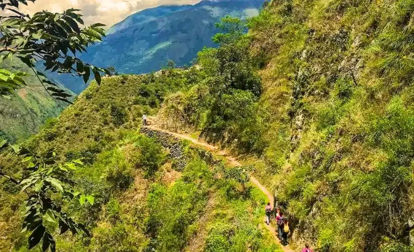
On the final stretch toward Machu Picchu, the route combines natural scenery with signs of human presence, such as trails, farming areas, and views of the mountains surrounding the citadel. High jungle vegetation remains present, and the terrain becomes more enclosed at several points.
This part of the route offers a visual transition toward the surroundings of Machu Picchu. Being close to the citadel does not mean that the physical effort disappears, so it is advisable to save energy, stay hydrated, and confirm the logistics for tickets, trains, or transfers in advance if they are included in the itinerary.
Views from Llactapata
From Llactapata, you can enjoy panoramic views of the mountains and, when the weather allows, the surroundings of Machu Picchu. This point lets you see the citadel from a more distant perspective and understand its location among vegetation-covered mountains.
Cloud cover is frequent and may completely or partially hide the landscape. Therefore, a clear view cannot be guaranteed. Even so, the area offers an excellent panorama of the terrain and ravines surrounding Machu Picchu, especially when the mist briefly clears.
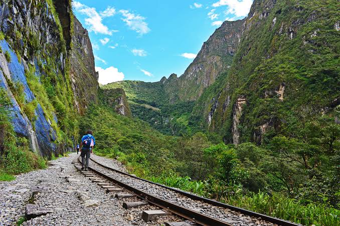
The Route to Aguas Calientes
The route to Aguas Calientes is accompanied by green mountains, rivers, and high jungle vegetation. In several sections, the terrain narrows and the scenery focuses on tree-covered slopes and the river’s course.
This section can be completed through different options depending on the booked or selected itinerary. Some options include hikes alongside the railway or transfers from nearby points. Before traveling, it is advisable to check which services are included and how much time is needed to reach Aguas Calientes without setbacks.
Arrival at Machu Picchu
The trek culminates with a visit to Machu Picchu, surrounded by green mountains, agricultural terraces, and Inca structures. The citadel’s location reveals how its buildings adapt to the slopes and terrain of the site.
The final view varies according to the visitor circuit, entry time, and weather. To coordinate tickets, itineraries, trains, or availability during high season, travelers can consult the Salkantay.tours team directly before confirming their trip.
What Is the Most Impressive Landscape on the Salkantay Trek?
The choice depends on each traveler’s interests. Some people prefer the snow-capped mountains and glaciers of the high areas; others value the color of Humantay Lagoon, the high jungle vegetation, or the arrival at Machu Picchu more.
The main advantage of this trek is that it is not limited to a single type of landscape. Travelers who enjoy photography often find different scenes every day, although they should keep in mind that weather can completely change the visibility and colors of the surroundings.
Best Mountain Views
Salkantay Pass and the areas near the snow-capped mountain are the main places to observe high-mountain scenery. There, you can see snow-covered peaks, rock faces, glaciers, and elevated valleys with a broad perspective of the route.
To make the most of these views, it is advisable to set out wearing warm clothing and protect electronic equipment from cold and moisture. The first hours of the day usually offer better chances of clear skies, although conditions are never completely predictable.
Best Jungle Landscapes
The descent sections and areas near the high jungle offer the most abundant vegetation on the route. The cloud forest, rivers, ferns, tall trees, and crops completely transform the appearance of the trek.
These sections are ideal for travelers who prefer green landscapes and humid environments. On the other hand, there may be rain, mud, insects, and reduced visibility due to mist. Bringing insect repellent, a waterproof cover for your backpack, and footwear with good grip helps you enjoy the trail more.
Best Views of Machu Picchu
Llactapata and the final section allow you to appreciate Machu Picchu’s mountainous surroundings from different perspectives. From Llactapata, when clouds allow, you can see the citadel in the distance; upon entering Machu Picchu, you can see its terraces and structures in greater detail.
Both views are complementary. The first shows Machu Picchu’s relationship with the surrounding mountains and vegetation; the second lets you explore the site from within. The best circuit choice will depend on available tickets and the regulations in effect on the date of your visit.